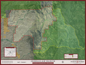
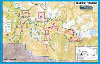
Maps play an important role in managing and marketing ranches, farms and recreational properties. We produce professional and affordable map products that effectively highlight land and resource attributes. We are dedicated to satisfying the unique needs of our customers and we work
with them to ensure that the right map solutions can be developed within their given budgets.
We utilize industry leading mapping and GIS software which gives us the ability to incorporate numerous geographic information resources to effectively draw property boundaries and produce maps that are highly
informative. Our map products typically display a combination of imagery and overlays such as topographic map images, aerial photography, land ownership, grazing allotments, roads, hydrology, contours, and
soil classifications - just to name a few. We can easily integrate GPS coordinates, survey, or CAD information when it is available.
Here are a few map examples from recent projects:
To discuss your mapping needs or request additional samples, please contact us.
In addition to traditional delivery of map images and prints we also provide interactive Map Viewers. YampaGeo Map Viewers offer a convenient and flexible way of delivering
3D and 2D interactive maps and PDF map images all bundled together and embedded into existing websites or property listings.
Learn more about YampaGeo Map Viewers here.
|
 |
|